

Turning a tract of raw Utah land into a thriving residential subdivision or multi-family neighborhood involves far more than just laying out house lots and pouring concrete foundations. Across the intermountain region, successful land development requires a careful balance of environmental awareness, regulatory navigation, and precise engineering design. Whether you’re scaling up a commercial site, expanding telecommunications networks, supporting energy infrastructure, or laying out a brand-new residential neighborhood, the foundation of every physical build is sound civil engineering and precise land surveying.
Many land developers and property owners enter the residential development process without a complete picture of the regulatory, environmental, and structural requirements enforced by local planning commissions. Missing a single essential scope, like a detailed geotechnical review, utility capacity analysis, or stormwater modeling, can lead to costly delays at the municipal planning desk or unexpected change orders during site grading.
By securing the civil engineering services needed for residential development, including initial due diligence, boundary mapping, grading/utility design, and construction staking, residential developers can streamline city approvals, optimize land yield, and protect project profitability.
Table of Contents
Phase 1: Feasibility, Boundary, and Topographic Land Surveying

Before any engineering design begins, precise spatial data must establish where the property lines exist, how the elevation shifts across the parcel, and what encumbrances or easements affect the title. Whether you’re working in mining, industrial energy, or housing, starting with bad baseline data guarantees expensive field fixes down the road.
Boundary Survey & ALTA/NSPS Mapping
An initial boundary survey formally documents legal property lines, overlaps, encroachments, and recorded rights-of-way. For major acquisitions, an ALTA/NSPS survey provides the gold standard of property mapping, giving lenders and title companies absolute clarity on recorded title exceptions and physical features.
Topographic Survey Integration
A detailed topographic land survey maps 3D contours, natural drainage swales, existing vegetation, rock outcrops, and structures to guide your site layout. Knowing the precise ground relief allows engineers to design structures that fit naturally into the terrain rather than fighting against it.
Strategic Feasibility Analysis
Feasibility studies evaluate slope constraints, access points, and local zoning ordinances (like density restrictions and setback rules) before significant capital gets committed. This early due diligence phase helps developers determine maximum lot counts and spot potential deal-breakers early on.
The Utah Foothills: Developing along Utah’s foothill locations (such as the Wasatch Bench or Traverse Ridge) requires high-resolution topographic mapping to navigate steep slopes, active fault lines, and geologic hazard setback zones enforced by local cities and the Utah Geological Survey.
Phase 2: Civil Site Layout, Subdivision Platting, and Grading Design
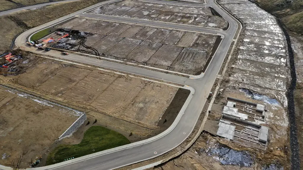
Once the baseline survey is complete, a skilled land development civil engineer transforms the initial site concept into a code-compliant, buildable layout and official preliminary plat.
| Phase Step | Key Engineering Deliverables | Core Project Benefits |
| 1. Spatial & Site Mapping | ALTA/NSPS mapping, topographic land survey, feasibility analysis | Establishes precise boundary lines, identifies geologic hazards, and validates zoning viability. |
| 2. Layout & Platting Design | Subdivision platting and site layout process, lot and street geometry | Optimizes usable parcel yield, balances vehicular/pedestrian flow, and secures preliminary city approval. |
| 3. Grading & Infrastructure | Grading and utility design for residential lots, earthwork balance | Eliminates drainage risks, balances cut-and-fill dirt volumes, and sets construction-ready pad elevations. |
Lot & Street Geometry Layout
Executing a smooth subdivision platting and site layout process optimizes building pad locations, driveway access, cul-de-sacs, and sidewalk placements. The goal is always balancing vehicular safety and pedestrian flow with maximum usable land yield.
Grading, Drainage, and Earthwork Design
Comprehensive grading and utility design for residential lots turns raw topography into pad-ready building sites. Engineers design exact earthwork cut and fill operations to balance dirt movement across the parcel while directing surface runoff safely away from home foundations.
Subdivision Platting Approvals
Drafting the legal subdivision plat is required by county recorders and city councils to legally split raw acreage into individual parcel numbers. This step formally creates the rights-of-way, common areas, and individual lots that make up the finished community.
Local Compliance: Municipalities in Salt Lake and Utah counties enforce strict adherence to local public works standards for maximum street grades, emergency vehicle turnarounds, and ADA-compliant pedestrian ramps.
Phase 3: Wet/Dry Utility Infrastructure and Stormwater Design

Modern residential communities require complete, high-capacity infrastructure networks—clean drinking water, sanitary sewer, storm drainage, electric power, gas, and telecommunications—designed to handle peak neighborhood demand without taxing existing municipal lines.
Water & Sanitary Sewer Systems
Engineers calculate pipe sizing, water pressure requirements, fire flow capacity, and gravity sewer slope to connect seamlessly into municipal mainlines. Proper modeling ensures reliable home water pressure while meeting rigorous local fire department flow requirements.
Stormwater Management & SWPPP Compliance
Designing a comprehensive stormwater management plan includes retention or detention basins, underground storage chambers, and erosion control measures. Creating a formal Storm Water Pollution Prevention Plan (SWPPP) ensures compliance with the state’s Division of Water Quality regulations administered by the Utah Department of Environmental Quality.
Dry Utility Easement Coordination
Effective utility easement coordination involves working directly with local power, natural gas, and fiber optic providers to map trench lines and shared corridors early. Managing these connections in the digital blueprint phase prevents costly main line conflicts during site excavation.
Utah Water Rule: With strict water conservation standards and secondary irrigation rules across Utah cities, designing dual-water distribution systems (separating culinary water from secondary irrigation) is often mandatory for new residential developments.
The Anderson Psomas Advantage in Land Development
Bringing a complex civil project to life requires seamless collaboration across disciplines. Anderson Psomas delivers an end-to-end, single-source solution for residential, commercial, industrial, and energy sector development—combining in-house land surveying, civil site design, utility engineering, and municipal approvals under one roof.
Our Core In-House Services
- Land Surveying & Mapping: Boundary surveys, ALTA/NSPS mapping, 3D topographic mapping, and construction staking.
- Civil Site Engineering: Site layout design, grading plans, earthwork cut-and-fill analysis, and subdivision platting.
- Utility & Environmental Engineering: Water/sewer mainline modeling, stormwater management plans, SWPPP compliance, and dry utility easement coordination.
- Entitlements & Municipal Processing: Navigating city councils, planning commissions, and public works department approvals.
Our Integrated Process
Our team works hand-in-hand with developers, architects, and city staff from concept sketch through final construction staking. By catching utility clashes and earthwork imbalances digitally in our engineering software, we avoid expensive field adjustments after heavy machinery hits the site.
Unmatched Client Value
Partnering with a full-service firm minimizes hand-off delays, accelerates the municipal planning commission approval timeline, and delivers a fully engineered site ready for home construction. When your surveying and engineering teams sit in the same room, decisions happen faster, plans are more accurate, and projects stay on budget.
Moving Your Land Development Project Forward
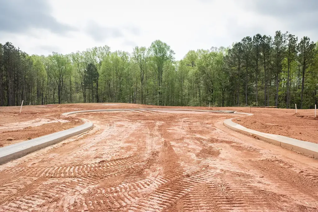
Bringing a residential development to life requires a synchronized progression of engineering services—starting with accurate land surveying, moving through smart grading and utility design, and finishing with approved subdivision plats. Skipping steps or cutting corners during early due diligence almost always leads to costly headaches down the road.
By securing the right residential development engineering services early, developers avoid regulatory roadblocks, maximize usable lot yield, and build vibrant, long-lasting residential communities.
Planning a new residential subdivision, commercial build, or lot split in Utah? Contact the civil design and land surveying specialists at Anderson Psomas today to discuss your site plans and get your project moving in the right direction.