Disclaimer: Portions of this article were produced with the assistance of Large Language Models (LLMs) and AI tools to enhance search engine optimization (SEO). The content is intended for informational purposes and may not address specific project needs. For tailored advice or to discuss your project, please contact Anderson Engineering directly.
Table of Contents
Mapping all city streets, subdivisions, city lots, major features, and city utilities
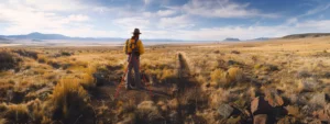
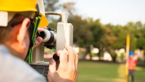
Anderson Engineering completed a GIS mapping of the city of Grants, NM. The mapping included all city streets, subdivisions, various city lots and major features. The entire city infrastructure was also mapped and made part of the GIS information. The city zoning and enhanced 911 system were also incorporated by Anderson into the GIS database. Actual addresses within the city were confirmed in the field for accuracy of the enhanced 911 system.
This blog post will delve into the various factors that influence land survey costs and illuminate why investing in a professional, accurate survey is a foundational element for any successful land-related endeavor in the Beehive State.
Unlock the potential of your projects with a top Utah structural engineering firm. Experience innovative designs and expert solutions tailored to your needs.
mountain, new mexico, el malpais national monument, mexico, mount taylor, ice, acoma pueblo, el morro national monument, hiking, volcano, trail, lava, uranium, mining, chaco culture national historical park, national, navajo nation, atlantic and pacific railroad, desert, pueblo, cave, ancestral puebloans, trail of the ancients, trail of the ancients scenic byway, navajo, laguna pueblo, ice cave, uranium mining, snow, mesa, sandstone, art, lake, geographic data and information, geographic information system, data, internet, software as a service, esri, geology, geography, technology, flood, cell, software, cartography, natural resource, spatial analysis, remote sensing, road, aerial photography, earth, elevation, management, pollution, united states geological survey, statistic, tool, database, satellite imagery, data management, digital elevation model, computer, pixel, satellite, arcgis, gis technology, online, mygeodata, imageserver, infrastructure, water, organization, image, education, geographic coordinate system, asset management, polygon, vegetable, asset, lidar, soil, transport, shape, global positioning system, topography, area, server, data analysis, real estate, interpolation, spatial database, climate, api, camera, arcinfo, latitude, cloud computing, digital data, color, national geographic, surveying, system, computer cartography, public utility, pdf, energy, intelligence, climate change, learning, longitude, research, science, information, density, sustainable development, engineering, earth science, geometry, scientist, qgis, knowledge, resource, phenomenon, disaster response, marketing, web application, stream, autodesk, moderate resolution imaging spectroradiometer, topology, problem solving, openstreetmap, electricity, workflow, forest, fire hydrant, webgis, open gis, geo gis, arc gis on line, freegis, bureau of land management, grants hotels nm
Frequently Asked Questions
What is the elevation of City of Grants, New Mexico?
The elevation of the City of Grants, New Mexico, is approximately 6,332 feet (1,932 meters) above sea level.
What is the average temperature in City of Grants, New Mexico?
The average temperature in the City of Grants, New Mexico, typically ranges from the mid-30s°F in winter to the mid-80s°F in summer, providing a diverse climate throughout the year.
Is City of Grants, New Mexico a rural or urban area?
The City of Grants, New Mexico, is considered an urban area. It features city infrastructure, residential neighborhoods, and commercial development, distinguishing it from more rural regions in the state.
How far is City of Grants, New Mexico from Albuquerque?
The distance from the City of Grants, New Mexico, to Albuquerque is approximately 75 miles. This makes Grants easily accessible for both residents and visitors traveling to and from the state’s largest city.
Who is the current mayor of City of Grants, New Mexico?
The current mayor of the City of Grants, New Mexico, is Martin A. "Marty" K. T. Valenzuela.
What is the population of City of Grants, New Mexico?
The population of the City of Grants, New Mexico, is approximately 9,000 residents, according to the latest census data. This figure reflects the city's status as a small but vital community in the region.
When was City of Grants, New Mexico founded?
The City of Grants, New Mexico, was founded in 1883. This historic establishment laid the groundwork for its development as a significant location in the region.
Is City of Grants, New Mexico a popular tourist destination?
The City of Grants, New Mexico, is not widely recognized as a major tourist destination but offers unique attractions, including scenic landscapes, historical sites, and outdoor activities that appeal to visitors seeking a more off-the-beaten-path experience.
What historic sites are in City of Grants?
The historic sites in the City of Grants include the historic Route 66, the El Malpais National Monument, and the stunning remnants of ancient lava flows and Native American cliff dwellings, each reflecting the rich cultural heritage of the area.
What recreational activities are available in Grants?
Recreational activities available in Grants include hiking, fishing, and camping, as well as access to local parks and outdoor facilities that promote active enjoyment of the area's natural beauty.
How does Grants handle urban development challenges?
Grants manages urban development challenges through collaborative planning, leveraging GIS technology for effective mapping, and engaging stakeholders to ensure sustainable and compliant growth that meets the community's needs.
What schools are located in City of Grants?
The schools located in the City of Grants include Grants High School, Los Alamitos Middle School, and several elementary schools such as Central Elementary and Mountainview Elementary, serving the educational needs of the community.
What is the primary economic activity in Grants?
The primary economic activity in Grants is centered around resource extraction, particularly mining, alongside tourism and services that support the local community and economy.
What public services are available in Grants?
Public services available in Grants include essential amenities such as water and wastewater management, public safety services (police and fire departments), waste management, and community facilities. Additionally, various recreational and educational services are accessible to residents.
Are there any annual events in City of Grants?
The City of Grants hosts several annual events that celebrate the community, including the Grants Rodeo, the annual Arts and Crafts Festival, and seasonal celebrations like the holiday parade, providing fun and engagement for residents and visitors alike.
What transportation options are available in Grants?
The transportation options available in Grants include public transit services, personal vehicle access, and connections to major highways, facilitating convenient travel for residents and visitors alike.
How does the city address environmental issues?
The city addresses environmental issues by implementing sustainable practices, enforcing regulations to protect natural resources, and promoting community engagement in environmental initiatives. These efforts aim to ensure a healthier ecosystem and improve the quality of life for residents.
What landmarks define City of Grants, New Mexico?
The landmarks that define the City of Grants, New Mexico, include historic sites such as the El Malpais National Monument and the Route 66 corridor, along with local attractions like the Grants Mining Museum and nearby natural features like Mt. Taylor.
What are popular dining options in Grants?
Popular dining options in Grants include local favorites such as El Rancho Restaurant, known for its New Mexican cuisine, and popular fast-food chains. Visitors can also explore diverse options, from cafes to diners offering a range of delicious meals.
What demographics characterize the population of Grants?
The demographics that characterize the population of Grants, New Mexico, include a diverse mix of ethnicities, with a significant Hispanic community, varying age groups, and a blend of urban and rural residents, reflecting the city's rich cultural heritage.
How does City of Grants manage public safety?
The City of Grants manages public safety through a collaborative approach involving local law enforcement, fire departments, and community programs, ensuring effective emergency response, crime prevention, and public awareness initiatives to safeguard residents and visitors.
What healthcare facilities exist in City of Grants?
The healthcare facilities in the City of Grants include local clinics, hospitals, and urgent care centers that provide a range of medical services to residents, ensuring comprehensive healthcare access within the community.
What historical events shaped City of Grants?
The historical events that shaped the City of Grants include its establishment as a railroad town in the late 19th century, the discovery of nearby coal deposits, and its evolution through various economic phases, significantly influencing its growth and infrastructure development.
What is the significance of the local culture?
The significance of the local culture lies in its ability to shape community identity, foster social cohesion, and preserve unique traditions and history, enriching the overall quality of life for residents and attracting visitors to the region.
How does Grants support local businesses?
Grants supports local businesses by offering various resources such as financial incentives, technical assistance, and networking opportunities, fostering economic growth and encouraging community engagement for entrepreneurs and small business owners.
What is the crime rate in City of Grants?
The crime rate in the City of Grants indicates the level of criminal activity within the area. Recent statistics show that the city experiences a moderate level of crime compared to state and national averages, highlighting the importance of community safety initiatives.
How do climate conditions affect city planning?
Climate conditions significantly influence city planning. Factors like temperature, precipitation, and extreme weather events inform infrastructure design, resource management, and sustainability practices to create resilient urban environments that can adapt to changing climate patterns.
What infrastructure projects are ongoing in Grants?
Current infrastructure projects in Grants include roadway improvements, water system upgrades, and enhancements to public facilities aimed at supporting community growth and ensuring efficient service delivery.
What role does tourism play in Grants economy?
The role of tourism in Grants' economy is significant, as it stimulates local businesses, creates jobs, and enhances community development by attracting visitors to the area’s historical sites, outdoor activities, and cultural events.
What are the zoning laws in City of Grants?
The zoning laws in the City of Grants govern land use, including residential, commercial, and industrial areas, to ensure orderly development and community welfare. For specific regulations, refer to the city’s planning department or official website.
anderson gis, grants new mexico map, gis new mexico, grant new mexico map, new mexico gis, city of grants new mexico, gis, grants nm map, elevation grants nm, grants nm elevation, elevation of grants nm